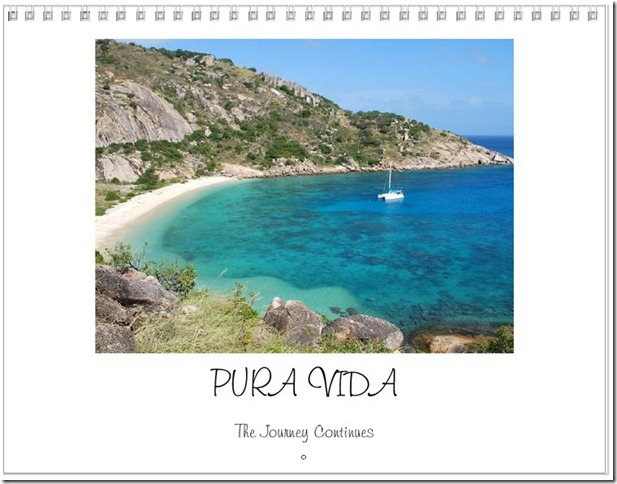
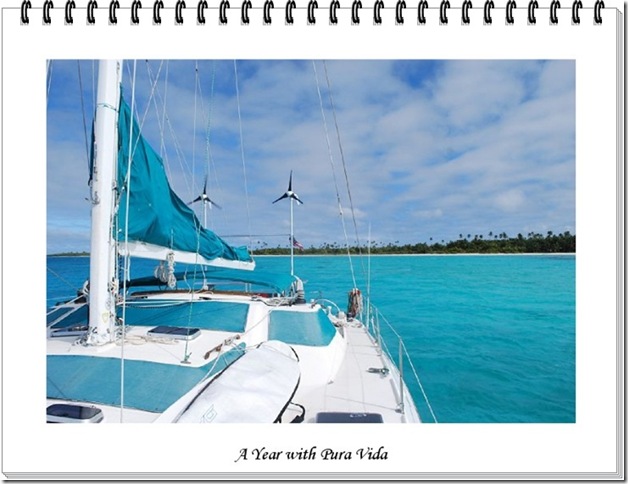
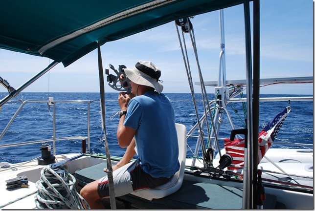
Get your very own 2011 Pura Vida calendar! If you have enjoyed checking out the photos over the last year, then you will appreciate having their beauty captured on the wall of your home or office. Calendars are $20, paid through Paypal, which covers printing on heavy cardstock paper and shipping. Just send Lauren an email (lricherson@hotmail.com) if you are interested, and your calendar will be mailed to you via U.S.P.S.
We’ve officially decided on the route for the remainder of our trip: we’re headed home via South Africa instead of the Suez Canal. The Somali piracy issue was a bit of a concern, but the bigger reasons are keeping on schedule and staying close to our budget. Due to the timing of the seasons and passages, the Suez route would have taken us an extra 6-12 months. We hadn’t originally planned to visit New Zealand, but we really wanted to extend our time in the Pacific after a late start and we really did enjoy our time there. We’re definitely going to miss the opportunity to see Asia, the Middle East, and the Med, but we are starting to look forward to Madagascar, Africa, and Brazil and we’re still relatively young. We keep telling ourselves this is only our first time around. Bali is our last chance to change our minds, but we’ve ordered the charts to get to South Africa and it’s looking pretty final.
 Now if only we could get Google Maps to print out directions for us…
The traditional route to South Africa passes from the Cocos Keeling Islands to Mauritius and then south of Madagascar and on to Durban. The area from the southern tip of Madagascar to Durban is notorious for large, confused seas and the sea near Durban can be even worse. From Durban to the cape, the incredibly strong Aghulas current can flow south at 7-9 knots and is often opposed by strong southwesterly gales from the open waters of the southern ocean. The result is that incredibly steep 20 meter seas are not uncommon and a great deal of care attention to the weather is necessary and rough weather is sometimes unavoidable. Getting to Durban at the end of a 1200 nm passage without a chance to pick a proper weather window didn’t sound too good to me, so we’re planning to go north of Madagascar.
The route north of Madagascar adds a few miles, but it lets us stay in the tradewinds longer and avoid the large, confused seas off the southern tip of Madagascar. We’ll run down the west side of Madagascar, cross the Mozambique channel where it’s narrow enough that we can go on a good weather window and then make coastal hops down the coast of Mozambique to South Africa as the weather allows. We’re hoping the route will be safer and also give us a chance to see some interesting places. We haven’t decided whether or not to stop in the Chagos on the way, but in either case the route should take us a least 200 miles farther out from Somalia than any previous pirate attack has occurred (to date the pirates have been working up to 800 miles offshore). Now we just have to manage to sail 2000 nm a month for the next few months…
Get your very own 2010 Pura Vida calendar! If you have enjoyed checking out the photos of the idyllic South Pacific islands, then you will appreciate having their beauty captured on the wall of your home or office. Calendars are $20, paid through paypal, which covers printing on heavy cardstock paper and shipping. Just send Lauren an email (lricherson@hotmail.com) if you are interested, and your calendar will be mailed to you via U.S.P.S.
Here are answers to a couple of navigation questions from Margo. We’ve had several people ask about this, and although there can be a lot to watch out for, navigating isn’t nearly the challenge it used to be.
Q: Could you write about navigation for those of us who are nautically challenged? Like how does it work at night and what is "along the rhumb line? Is it all high tech gadgets or do you still use the stars?
A: The short answer is that thanks to GPS and modern electronics, most of the time things are at least as simple as using an in-car GPS unit to navigate your way through an unfamiliar town on vacation. Of course we’re only travelling about 5 mph, so things happen a bit slower.
The rhumb line is just a nautical term for the straight-line course between two points – draw a straight line between your point of departure and your destination on a typical map, and that’s the rhumb line. On land, you would use the phrase “as the crow flies” to mean the same thing. The shortest distance between two points on the earth is actually called the great circle route, and it takes into account the fact that the earth is round. But, for shorter passages, the rhumb line is close enough and it’s used as the shortest path to your destination.
Navigation is basically the job of knowing where you’re at and setting your course so that you’re travelling in the direction you intend to. Near land, where there are markers and numerous reference points, it’s called piloting. Offshore navigation involves finding your way when you can’t see anything but sky and water. Just 25 years ago, the offshore sailor’s day revolved around taking sextant sights at various points during the day, and anyone who wanted to sail across an ocean had to trust their life to their celestial navigation capabilities. Navigating successfully without a GPS is a pretty impressive task that requires a number of skills, a lot of work, and some luck in terms of having a good enough view of celestial bodies to regularly get an accurate position fix.
We have several ways to navigate, so here’s a quick rundown…
1. Most of the time we navigate using our Raymarine C70 chartplotter. The charplotter is basically a small, waterproof, specialized computer, with a 7 inch screen that is connected to a GPS and is installed outside at the helm station. We plug in a Flash card with marine charts (like plugging in a USB thumb drive into a PC) and then our current position is displayed in the form of a little boat icon on top of the chart background. Charts are basically maps for sailors. They contain detailed information about a number of things, including water depths, locations of hazards like rocks, shoals, and wrecks, strong currents, and “aids to mariners” or marker and buoys that are placed near land to help you identify where you’re at and control the movement of marine traffic. Using the GPS, the chartplotter is able to tell us what our true speed and course over the ground are. This is different from the speed and heading provided by our knotmeter (device that measures out speed trough the water / boat speedometer) and compass heading because of local magnetic variation, leeway (wind pushing us sideways), and current, which could be pushing us in any given direction. Using the chartplotter is pretty straightforward and even someone who is unfamiliar with boating can get the basic hang of it pretty quickly. It’s pretty much like the GPS units used in cars except that it’s waterproof, the charts are expensive, and it also provides critical heading and speed information generated based on GPS.
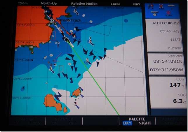 The modern navigatorL our chartplotter screen as we were leaving Balboa, Panama. The large box on the left shows our location on the chart, zoomed out to a fairly large scale. The green line is where we’re headed (in nautical terms, our Course Over Ground, which is different from our heading). The dark triangles come from our AIS system and represent other boats — there are a lot of ships near the canal entrance. On the right side, the top box tell us the distance, bearing, and time (at our current speed) to our destination. The middle box is our current latitude and longitude. The bottom box provides course and speed over the ground.
2. Murphy’s law seems to work overtime at sea, so we have some sort of redundancy plan for nearly every piece of gear on the boat. If we lose electricity or some part of the chartplotter system fails, we have a number of backups. The first and most reliable backup is paper charts of the area we’re sailing in combined with a handheld, battery-powered GPS to pinpoint our position. We use half-size black and white charts for backup due to the low cost and have three inexpensive Garmin eTrex handheld GPS units with plenty of spare batteries on board for finding our position without electricity on the boat.
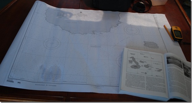 As we neared Puerto Ayora in the Galapagos, we pulled out the paper chart, our cruising guide, and one of our handheld GPS units (yellow Garmin eTrex on the right).
3. We can also use the handheld GPS units with our laptops to locate our position on computer-based charts. This can be pretty nice, especially since have computer charts for most all of the world. Because one brand of software that includes this capability along with world-wide charts has been pirated and passed freely among sailors for several years (at this point, we haven’t met anyone who doesn’t have a copy), it is the primary navigation source for more than a few people, but it’s also dependent upon electricity and a laptop functioning.
4. We do have a sextant and all the necessary almanacs, sight reduction tables, etc. on-board to perform celestial navigation using the sun, moon, and stars (we also have a battery-powered shortwave radio to pick up the time signals needed to keep our watches accurate). I’ve practiced noon sights (getting a good latitude and rough longitude reading at noon), but so far haven’t moved on to the more complex sights.
5. There are some other emergency-type navigation techniques that are good to be aware of, but are pretty unlikely to come into use. One of my favorites was the one used by the inexperienced 19-year old solo circumnavigator Tania Aebi before she finally figured out that her sextant was warped – she just sailed in the direction she needed to go and then radioed to passing ships to verify her location. Another funny rumored method that I was told about was practiced by some Russian sailors who reportedly sailed from southern California to Hawaii by following the passenger jets overhead.
Offshore, day and night navigation are basically the same when you’re using a GPS. Because we’re essentially always in unfamiliar places, we almost always make landfall during the daylight, even if it means we have to anchor off, drift, or slow the boat down to avoid reaching land in the dark. Charts and GPS are great, but when you’re close to land and reefs, there’s no substitute for a keeping a sharp watch.
Even though it’s a 2000+ nm detour for most circumnavigators, New Zealand is a popular cruising destination. In addition to providing a good place for boat repairs and offering natural and cultrual tourist attractions, it is almost completely out of the hurricane region of the South Pacific, making it a safe place to spend the hurricane season.
The passage there and back, however, has a bad reputation among sailors for being rough and potentially dangerous. When to make the passage and how to approach it is a common topic among cruisers this time of year. Although people who make the trip regularly or have a number of New Zealand passages under their belt seem to think it’s not too big of a deal, those of us who haven’t done it yet are all a little nervous. We’ve spent several months in the reasonably-predictable tradewinds and sailing to such a high latitude is always more uncertain.
The weather worries have a couple of sources. The first is that weather forecasts are usually only reliable for 3-5 days, after that, they’re much less accurate and anything over a week seems to be more like an educated guess. Most boats make 100-150 nm a day and the passage to New Zealand is about 1000-1200 nm. When heading southward, this means that you’re leaving the tradewinds and heading into the region of variable winds right around the time your departure weather forecast is getting stale, so can’t be sure what you’re going to get — calms, wind on the nose, a nice beam reach, or a SW gale. The timing of the passage is also a topic of discussion. The southern hemisphere seasons are changing from winter to summer. If you leave too early, you’re pretty much guaranteed a stong SW winter gale at some point. If you leave too late, you could be risking a hurriance either where you’re waiting to depart or possibly along the way. Hurricanes in November are rare, but they do happen, especially in El Nino years (this is currently a weak El Nino period). Winter storms are a guarantee in October, and summer weather starts to really settle in during December. Although the conditions may be uncomfortable, they’re generally not unsafe, although there have been a few occasions when boats on passage to or from New Zealand were hit with very strong, unpredicted winds from a quick-forming tropical storm or a “squash zone” (compresed isobars and high winds between nearby low and high pressure zones).
Advice based on absolutely avoiding hurricanes says to leave by the beginning of November, but the experienced sailors we’ve talked to say that the better passages are made later, sometimes well into December, albeit with some hurricane risk. It’s tempting to stay in beautiful and comfortable Vava’u, but we’re sticking with our original plan of leaving during the first week of November. Our plan, like that of many others we’ve spoken to, is to use modern communications and weather forecasting to our advantage. We’ll try to time our departure for a weather window that looks good, but we’ll also be updating our forecast information along the way. If it looks like a gale is coming to the area north of New Zealand, we’ll drift, heave-to, or set our sea anchor for a couple of days and let it pass in front of us before continuing. We’re also carrying plenty of fuel, changing the engine oil before leaving, and we’ll be much more ready to motor if the winds are light or contrary. We have roughly an 800 nm range under power, although hopefully we don’t have to motor anywhere near that much.
The weather forecast for the next week shows lots of wind on the nose south of the tradewinds — weak winds from a high and then strong SW winds as a low moves through. We’re hoping that next week looks better.


