Lat: 12 00.177′ S
Long: 21 53.936′ W
After a couple of days of things not quite going our way, a day arrived for celebration. Not only did we reach the halfway mark of the St Helene-Recife passage, but the Pura Vida hosted her first mid-Ocean birthday celebration!
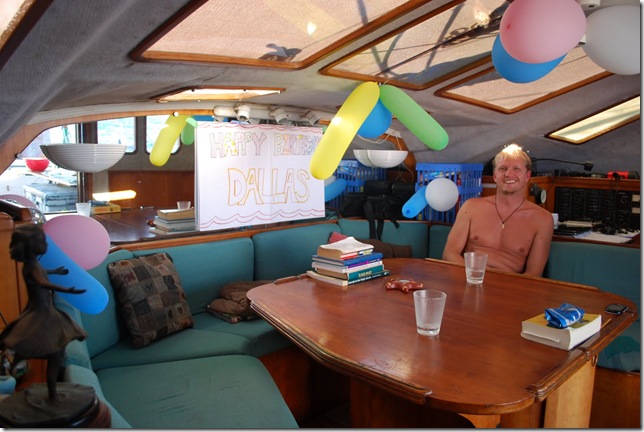
Upon waking to his dawn watch shift, Dallas was surprised by balloons in the salon and a colourful "HAPPY BIRTHDAY DALLAS" banner. When making the banner, Lauren had used the back of what she thought was an old chart, having seen the continent of Africa featured, and feeling confident that that region had now been left behind. Only afterwards did she notice the chart also featured the rest of the Atlantic plus South America… our destination. Nevertheless, the chart is still useable and is now uniquely enhanced with bits of coloured marker from the reverse reading "SALLAD YADHTRIB YPPAH".
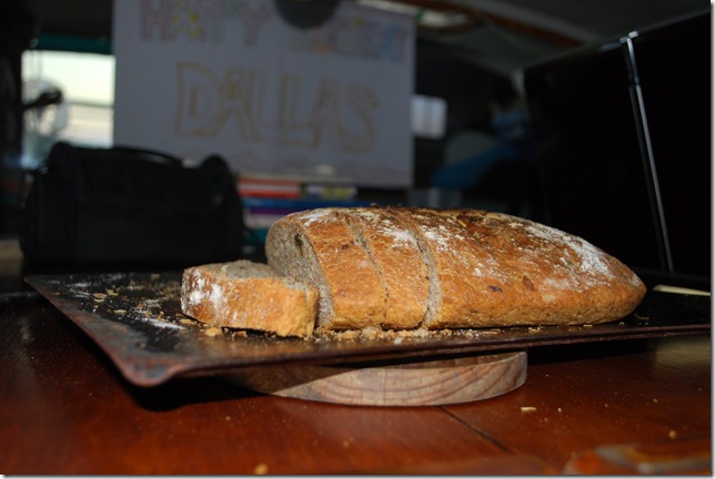
As per usual, resident chef Lauren outdid herself with both a scrumptious birthday lunch and dinner, but now birthday boy and guest chef Dallas also got into the mix and produced a yummy garlic and olive bread, which is disappearing almost as fast as the delicious lures he has been making (the local fishies have munched 2 of his lure creations right off in almost as many days!)
Later in the afternoon, "890 miles to go" marked the passage halfway stage and added to the day’s celebratory mood.
On the sailing front, although the winds have lightened somewhat, at least they are once again consistent and after the previous couple of overcast and squally days, we are also once more enjoying soaking up some of that glorious south Atlantic sunshine during the day and some heavenly star-gazing at night.
Lat: 13 32.186′ S
Lon: 16 11.321′ W
The last couple of days haven’t been our best. Skies have been overcast and we’ve been surrounded by rain squalls from hours before dawn until nearly sunset. Between the squalls, winds have been extremely light and the squalls themselves have resulted in winds shifting around through 180 degrees within a 24 hour period. Yesterday we had wind on the starboard beam at one point and right now it’s on the port beam. It’s feels like an early taste of the ITCZ. It’s been nice hearing from other boats on our twice-daily radio skeds and it sounds like light winds have been the norm for everyone so far, although boats that have crossed north of the ITCZ are finding the NE trades to be stronger and more reliable.
Unfortunately the weather hasn’t been our only problem. Yesterday morning Tracey and I were setting the spinnaker, which had become nice and routine, when I made the mistake of pulling the line to raise the sock surrounding it before she had a chance to cleat off the halyard. She was hosting the sail in it’s sock and my job was to pull the line that raised the sock and exposed the sail once it was raised and in position. I failed to make sure she was finished before I started, and as a result the full spinnaker popped out of the sock and filled with air while the halyard (line used to raise the sail) was still in her hands instead of cleated off securely. A spinnaker full of air produces quite a bit of force, and the result was a pretty bad case of rope burn on her left hand and a few burn spots on her leg as well caused by flaked halyard line running free. Within a couple of seconds, the bitter end of the halyard was at the top of the mast and the spinnaker was in the water underneath the boat. Just when you’ve got something down to a routine…
Luckily conditions were light, so we had time to get the fishing lines in before they were tangled in the props. Tracey got some burn cream on her hand and leg while we managed to pull the spinnaker to the bow and out of the water. Going up the stick at sea is always an adventure. Even in very good conditions, you’re still holding on with both hands and both feet to keep from getting tossed around and against the mast like a lure dangling from a fishing pole. The spinnaker itself didn’t fare too badly. It has plenty of blue bits of bottom paint scattered here and there, and one panel has some abrasions and tears that were probably caused by barnacles on the bottom of the boat. After raising flying it for 40 minutes or so just before sunset, it was dry enough to put a bit of duct tape on both sides of the tears and re-hoist it. With Band-Aids (a.k.a. plasters) in place on both Tracey and the spinnaker we prepared for another night at sea. Hopefully there’s a sailmaker with a good selection of spinnaker cloth in Recife.
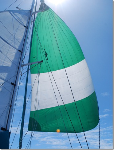 Duct tape really does work miracles…
Pulling in the fishing lines before dinner, we found that one of them had lost the leader and lure, which seemed about right for the day. Oh well, you can’t have sunny skies, calm seas, perfect breezes, and fish on the hook every day. Maybe tomorrow…
Lat: 14 22.457′ S
Long: 012 40.297′ W
It’s a beautiful, sunny day out here in the South Atlantic. Unlike the last couple of days in which our reliable trade winds were interrupted by a series of squalls carrying light winds and rain, today we have the more typical 15 knots of SE wind and are cruising along at over 6 knots.
We have been tuning in to hear BBC news each day and heard about the four American cruisers who were shot by the Somali pirates. We are pretty sure that we have seen their boat before but don’t know them personally. Regardless, it’s a tragic incident. I’m thankful that we are not on that route and concerned about others that are. The good news is that we received word today from our good friend Martin on S/V Anima, and he is safely in Yemen along with the other nine boats in his convoy. They still have to pass through the Bab el Mandeb with strong winds and occasional piracy, but they seem to be out of the most dangerous pirate territory.
Other than that, we’re just enjoying our leisure time and trying to finalize plans for the Caribbean. We are excited about our three groups of visitors tentatively scheduled to fly in from the U.S., but this means that we won’t have the space on board to take Tracey all the way to her destination (Antigua), so she will most likely be jumping off in Brazil. Bob from S/V Boomerang was teasing Dallas on the radio this morning, saying that he is one lucky man having two women on board. This runs counter to the old adage that it’s bad luck to have women on board, but I think that Bob’s got it right. Tracey couldn’t possibly be more enthusiastic or helpful, and she and I get along very well. Were this not the case, it could be a much different scenario!
Apparently the early explorers were well aware of the risks of coed crew. Dallas just finished reading “Blue Latitudes”, a recounting of Captain Cook’s three journeys mixed with entertaining stories from the author’s (Horowitz) visits to many of Cook’s landfalls. He shared some interesting info from the book over lunch. While women were prohibited from participating in the voyages of discovery that occurred during that period, a woman served on one vessel disguised as a man, and her gender went unnoticed all the way from Europe to Tahiti, where the transvestite-friendly Polynesians readily identified her as she stepped ashore!
It sounds like the gender rules were pretty justified considering the conditions on board. Their “head” consisted of a plank at the head of the boat extending over the water with large holes in which to sit! And imagine the atmosphere on board after the young sailors started imbibing their daily ration of a gallon of beer or a pint of rum! As much as I enjoy a good party, I think you would find me voluntarily marooned at the first port.
Not much else to report. We have about 1350 miles to go…
Lat: 15 23.910′ S
Lon: 8 16.420′ W
We set Saturday at noon as our departure time, so Saturday morning we started our last round of chores — changing the zinc on the port prop shaft, doing a bit of bottom cleaning, lugging the last load of water jugs, and doing our final provisioning. But, with only an hour or two to go, we heard a familiar sound on the radio: S/V Marionette was calling us to let us know that they were only an hour or so away from the anchorage.
We met them ashore and by time our late lunch was over, they’d talked us into staying the night. We counted about 10 times that we’ve run into them since first meeting in Panama, but this will be the last time. They’re headed north to the Cape Verde islands and back to Europe while we head west to Recife, Brazil. It’s fun to see them not just because we’ve become friends, but because they travel without an autopilot, shortwave radio, or sat phone, so we never know exactly where they are or when or where we’re going to see them.
With the extra time, we decided to spend the afternoon snorkeling one of the wrecks in the James Bay. Its caught fire with about 350 people aboard and sank without any loss of life. A portion of the stern is still above water most of the time, so it wasn’t too hard to find. The visibility here isn’t what it is in some places, but at 50′ or so, it’s still enough to enjoy the wreck and all the fish. There were plenty of tropical species and some incredibly large schools (hundreds and hundreds) of juvenile butterfly fish. We even saw a school of medium-sized bonito swim by, which was something we’ve never seen before. They look like a generic silver tuna-type fish, only a little narrower and with a black and white rectangular Polynesian-style tattoo on their flank. The wreck itself was pretty massive. After a couple of minutes, I gave up on trying to reach the bow and just turned back to enjoy the fish that seemed to prefer the stern.
 The stern of the wreck stuck above water at low tide
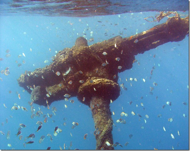 There were schools of hundreds of juvenile butterfly fish, the most we’ve ever seen
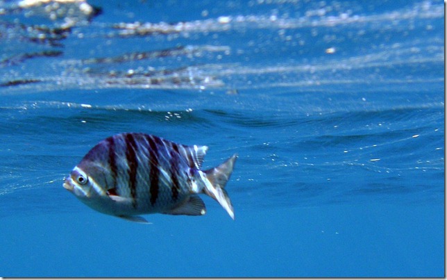 Not sure what this guy is, but he was photogenic
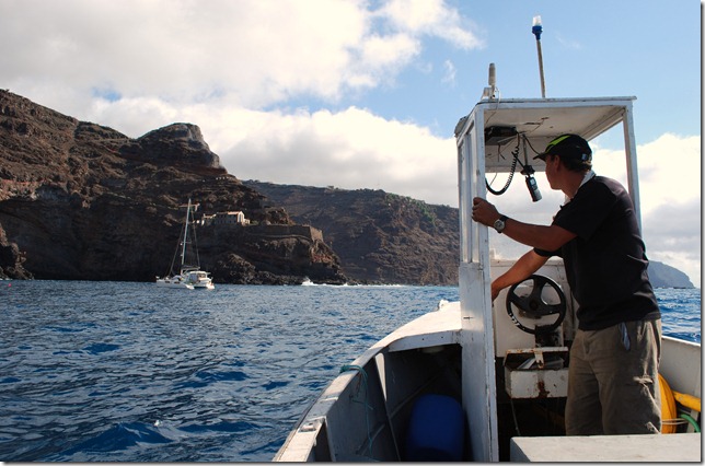
We were the only boat that had our dinghy in the water during the time we were there. The moon is nearly full, and the spring tides were causing the swell to sweep over the concrete wharf at a foot or two deep. Jumping off of the small, sturdy wooden ferry boat onto the concrete wharf as the swell is heaving and crashing on the nearby rocky shore is all about timing. I asked how bad it gets, and the ferry driver pointed to a steel railing atop the highest point on the sea wall. It’s about 15 or 20 feet above sea level, even at high tide. He said last year he put the keel of the ferry boat on that rail more than once in large swells. Under those conditions, he said he sometimes limits ferry passengers to the local fishermen, but he still runs the ferry every day. Apparently there haven’t been any serious injuries, but he does have to fish the occasional intoxicated would-be passenger out of the drink after an ill-timed leap.
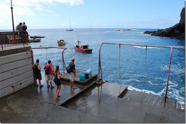 The swell was sometimes nearly to our knees while waiting for the ferry. Note the Tarzan ropes to help with getting on/off and the rail at the top left where the ferry (yellow boat left of center) has set its keel in a bad swell.
With no airport, St. Helena relies on a vessel called the RMS St. Helena for resupply and transit to South Africa. It’s normal route is Cape Town, St. Helena, Ascension and return, stopping in St. Helena every two weeks or so depending on weather and occasional changes in the route. There is a good-sized hospital with several doctors and a surgeon to care for the population of 3500, but if something too serious happens, our 75-year-old tour guide Robert advised that “well then, maybe you just pack it in and call it quits, see.” Apparently an airport has been in the works for 37 years. It’s still a topic of conversation, with some hoping for increased tourism and tax revenue and others concerned that it will change the island’s atmosphere forever. The “tele” only arrived here about 15 years ago and already the older generation say it’s eroded the social scene. Another unique thing about St. Helena is that it has no cell phone service. The island is served by landlines and 4-digit phone numbers. Considering how ubiquitous the cell phone has become it was a real surprise. We’ve been to places with huts and no electricity where you have to go into town or the next village to charge your phone, but there is still service. It think it’s the only place we’ve been where there is municipal electricity but no cell phone service (the other way around being not at all uncommon).
In one of the pubs, we met some “natives”, who often work on Ascension and the Falklands for years at a time in military bases. The natives are good-looking people with dark hair and skin. They’ve come from a variety of ethnic backgrounds since the island was discovered about 500 years ago, but seem to prefer being labeled as English. English is their first language, although through the generations it’s been passed down with such a strong and unique accent, that I asked several people before I was convinced that it is indeed the first and only language spoken here. They people of St. Helena are also incredibly friendly. You can strike up a nice conversation with pretty much anyone at any time, and I’ve never been the recipient of so much generosity in the pub. We went out with half the money we thought we would need and came back with half of it left.
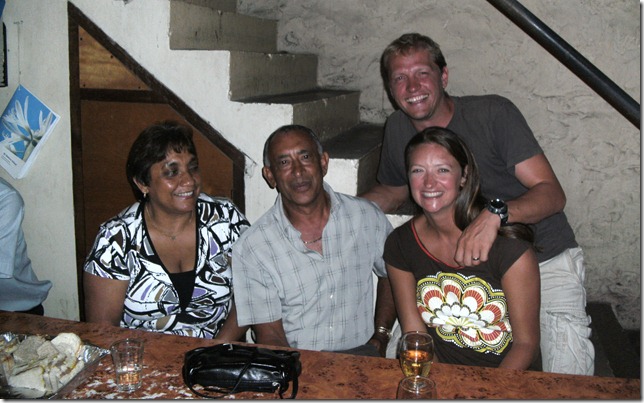 St. Helena has some of the friendliest locals we’ve met, and it pays to drink with the pub owner…
We timed our last jump off the of the ferry onto the boat at about 1 AM, and found a beautiful, fairly clear night, with a soft breeze out of the southeast. We decided to make an early start and by 1:30 AM we’d sailed off our anchor and away to the west without putting the engines in gear. I wasn’t worth much until about noon the next day, but the girls did a fine job of dealing with the sails, motoring through a calm, and raising the spinnaker. The spinnaker has been down once in fresher winds and is now back up. Skies have alternated between fully overcast and mostly clear. So far it seems like we’ve picked up where we left off before arriving at St. Helena, but with a little more wind and a bigger swell behind us.
As the sun rose on Wednesday morning, Dallas could easily make out a large mass of volcanic rock in the distance. I had the 12-3 a.m. watch, so by the time I arose, I could see the details of the east face of St. Helena Island. We rounded the north end and arrived at the anchorage on the northwest corner just in time for the rain. We threw on our jackets and went on deck to try to attach to a mooring that turned out to be a buoy on a shoestring. That wasn’t quite adequate to hold our 26,000-pound boat, so we tossed it off and took a little tour around the mooring field before settling on a place to anchor in 50’ of water atop a sandy bottom.
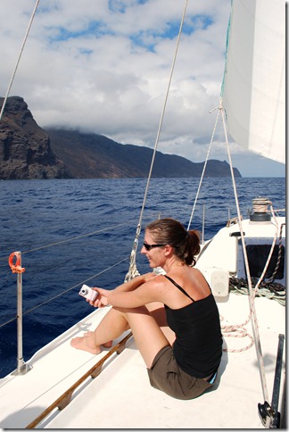 Tracey was in good spirits at the end of a very pleasant passage
We were excited to see that our French friends from S/V RDJ had already arrived that morning – well, at least I was. Maybe after being away from the U.S. for so long, I’m losing my competitive spirit, but after all, Dallas pointed out since they left Namibia a day before us, technically we were the winners of the “race”. (They weren’t persuaded by this to buy the evening beers, however.)
One of the first thing that we noticed about this anchorage was the intense swell. There is no breakwater (structure to provide protection), so it is not uncommon to see monohulls rocking back and forth at 45 degree angles. Also, there’s no safe place to leave the dinghy, so you must rely on the local ferries to bring you to and from shore and must jump onto the dock from the ferry boat with the assistance of some Tarzan-style ropes hanging there! For the most part, the ferry service has served us well, although it requires some advanced planning since the last ferry leaves at 6:45 p.m. If you want to return to your boat later than that, you have to book a time in advance, so our night out tonight will be time-limited. (Maybe this is for the best since we are leaving tomorrow!)
In addition to RDJ, we reconnected with some other friends from S/V Moose who have been here for a week already. Unfortunately, they will be here for another week waiting on another boat to arrive from Cape Town with their new autopilot. Their old one broke three days out of Cape Town, and they had to steer for 11 days by hand, just the two of them, with very impaired steering control (i.e., having to rotate the wheel 360 degrees just to change course by a few degrees). Needless to say, it was their worst passage ever, but they’ve been traveling with their boat for 11 happy years without such complications.
All of the 3,000 inhabitants of the island live in or near Jamestown which sits next to the anchorage. The inhabitants are British citizens, but most have descended from the Chinese and/or Indian laborers that were brought in as laborers and thus have dark skin. They are very friendly and interested in us yachties and our travel plans. We learned from Duncan and Irene (from S/V Moose) that one of the friendly locals was a popular and capable tour guide, so we booked our tour for Friday.
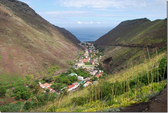 Jamestown is nestled in the valley
The island itself has an interesting history. It has been involved in several conflicts, as indicated by the ruins of military fortifications and look-out points that can be seen immediately as you arrive in the anchorage, which is the only way to arrive in St. Helena. Apparently, the fortifications didn’t always work out — for example, a German U-Boat shot down a British warship in the anchorage during World War II. However, the British did manage to keep Napoleon Bonaparte secure in exile here for almost six years until he died from stomach cancer in 1821.
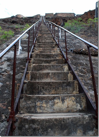
After learning these interesting tidbits, it was time to take care of business online and in the shops and to do some exploring of our own. Tracey and I hiked around one of the old military fortifications that overlooked the anchorage on Thursday morning, then went for broke and climbed Jacob’s Ladder that afternoon. The Ladder consists of 700 steep steps to the top of the mountain where another old fortification is located. Both trips provided nice views, and we both snapped photos incessantly (as we both tend to do).
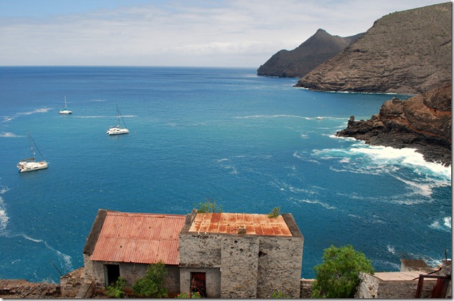 Pura Vida dwarfed by some large charter boats being delivered from South Africa to Europe
The record for climbing the Ladder is 5 minutes
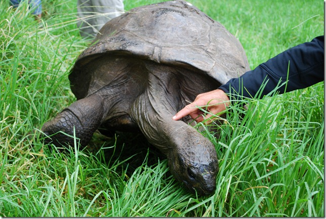
Today we met up with the guys from RDJ along with our local guide, Robert, for a trip around the island in the back of his pick-up truck. Unfortunately the weather didn’t totally cooperate with us, but we were able to get a feel for the place and its history. There is an abundance of different kinds of foliage here, from flax (which used to be their main industry until a cotton company moved in), to ferns, to cacti, to over a million of gum-trees that they have planted in the wetlands in an attempt to return it to its former state. In addition to these vistas, we were shown Napoleon’s home and gardens, his tomb (although empty since the French exhumed his body and returned it to France in 1840), and the resident tortoises, one of whom is estimated to be 174 years old!
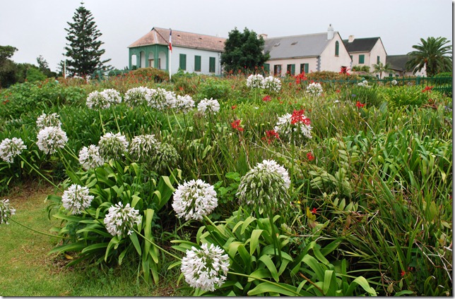 Longwood House was an old and isolated farmhouse restored for the purpose of Napoleon’s exile
St. Helena is nice, but after just a few days, I think we can safely say that we’ve been here and done that. This works out well, since we need to get going! We set sail for Recife, Brazil tomorrow and are hoping to average 5 knots so that we can make it there within 15 days…


