Here are answers to a couple of navigation questions from Margo. We’ve had several people ask about this, and although there can be a lot to watch out for, navigating isn’t nearly the challenge it used to be.
Q: Could you write about navigation for those of us who are nautically challenged? Like how does it work at night and what is "along the rhumb line? Is it all high tech gadgets or do you still use the stars?
A: The short answer is that thanks to GPS and modern electronics, most of the time things are at least as simple as using an in-car GPS unit to navigate your way through an unfamiliar town on vacation. Of course we’re only travelling about 5 mph, so things happen a bit slower.
The rhumb line is just a nautical term for the straight-line course between two points – draw a straight line between your point of departure and your destination on a typical map, and that’s the rhumb line. On land, you would use the phrase “as the crow flies” to mean the same thing. The shortest distance between two points on the earth is actually called the great circle route, and it takes into account the fact that the earth is round. But, for shorter passages, the rhumb line is close enough and it’s used as the shortest path to your destination.
Navigation is basically the job of knowing where you’re at and setting your course so that you’re travelling in the direction you intend to. Near land, where there are markers and numerous reference points, it’s called piloting. Offshore navigation involves finding your way when you can’t see anything but sky and water. Just 25 years ago, the offshore sailor’s day revolved around taking sextant sights at various points during the day, and anyone who wanted to sail across an ocean had to trust their life to their celestial navigation capabilities. Navigating successfully without a GPS is a pretty impressive task that requires a number of skills, a lot of work, and some luck in terms of having a good enough view of celestial bodies to regularly get an accurate position fix.
We have several ways to navigate, so here’s a quick rundown…
1. Most of the time we navigate using our Raymarine C70 chartplotter. The charplotter is basically a small, waterproof, specialized computer, with a 7 inch screen that is connected to a GPS and is installed outside at the helm station. We plug in a Flash card with marine charts (like plugging in a USB thumb drive into a PC) and then our current position is displayed in the form of a little boat icon on top of the chart background. Charts are basically maps for sailors. They contain detailed information about a number of things, including water depths, locations of hazards like rocks, shoals, and wrecks, strong currents, and “aids to mariners” or marker and buoys that are placed near land to help you identify where you’re at and control the movement of marine traffic. Using the GPS, the chartplotter is able to tell us what our true speed and course over the ground are. This is different from the speed and heading provided by our knotmeter (device that measures out speed trough the water / boat speedometer) and compass heading because of local magnetic variation, leeway (wind pushing us sideways), and current, which could be pushing us in any given direction. Using the chartplotter is pretty straightforward and even someone who is unfamiliar with boating can get the basic hang of it pretty quickly. It’s pretty much like the GPS units used in cars except that it’s waterproof, the charts are expensive, and it also provides critical heading and speed information generated based on GPS.
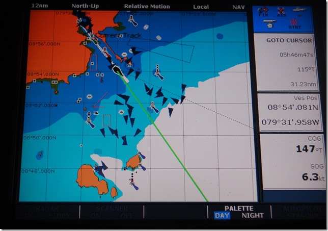
 The modern navigatorL our chartplotter screen as we were leaving Balboa, Panama. The large box on the left shows our location on the chart, zoomed out to a fairly large scale. The green line is where we’re headed (in nautical terms, our Course Over Ground, which is different from our heading). The dark triangles come from our AIS system and represent other boats — there are a lot of ships near the canal entrance. On the right side, the top box tell us the distance, bearing, and time (at our current speed) to our destination. The middle box is our current latitude and longitude. The bottom box provides course and speed over the ground.
2. Murphy’s law seems to work overtime at sea, so we have some sort of redundancy plan for nearly every piece of gear on the boat. If we lose electricity or some part of the chartplotter system fails, we have a number of backups. The first and most reliable backup is paper charts of the area we’re sailing in combined with a handheld, battery-powered GPS to pinpoint our position. We use half-size black and white charts for backup due to the low cost and have three inexpensive Garmin eTrex handheld GPS units with plenty of spare batteries on board for finding our position without electricity on the boat.
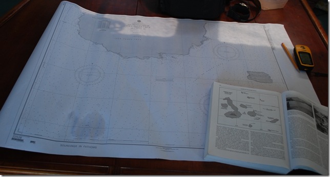
 As we neared Puerto Ayora in the Galapagos, we pulled out the paper chart, our cruising guide, and one of our handheld GPS units (yellow Garmin eTrex on the right).
3. We can also use the handheld GPS units with our laptops to locate our position on computer-based charts. This can be pretty nice, especially since have computer charts for most all of the world. Because one brand of software that includes this capability along with world-wide charts has been pirated and passed freely among sailors for several years (at this point, we haven’t met anyone who doesn’t have a copy), it is the primary navigation source for more than a few people, but it’s also dependent upon electricity and a laptop functioning.
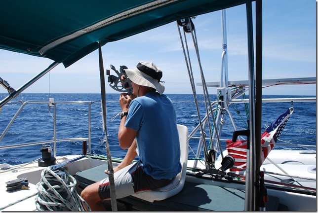
4. We do have a sextant and all the necessary almanacs, sight reduction tables, etc. on-board to perform celestial navigation using the sun, moon, and stars (we also have a battery-powered shortwave radio to pick up the time signals needed to keep our watches accurate). I’ve practiced noon sights (getting a good latitude and rough longitude reading at noon), but so far haven’t moved on to the more complex sights.
5. There are some other emergency-type navigation techniques that are good to be aware of, but are pretty unlikely to come into use. One of my favorites was the one used by the inexperienced 19-year old solo circumnavigator Tania Aebi before she finally figured out that her sextant was warped – she just sailed in the direction she needed to go and then radioed to passing ships to verify her location. Another funny rumored method that I was told about was practiced by some Russian sailors who reportedly sailed from southern California to Hawaii by following the passenger jets overhead.
Offshore, day and night navigation are basically the same when you’re using a GPS. Because we’re essentially always in unfamiliar places, we almost always make landfall during the daylight, even if it means we have to anchor off, drift, or slow the boat down to avoid reaching land in the dark. Charts and GPS are great, but when you’re close to land and reefs, there’s no substitute for a keeping a sharp watch.


